Did you know that the LaPlatte River (which passes through Hinesburg, Charlotte, and Shelburne, emptying into Lake Champlain at Shelburne Bay) has fair or poor water quality (consistently surpassing the state’s allowed levels for phosphorus), and the lower portions are impaired for E. coli (bacteria)? One of the reasons for this poor water quality is historic activities, such as the straightening of channels, creating berms next to streams, and building or filling in next to streams. This caused water in streams to move faster, which in turn caused down-cutting (the stream’s channel getting deeper by removing material from the stream’s bed). Erosion then occurs along stream banks, which adds sediment to the stream (and eventually, downstream sites, like Lake Champlain). Erosion often continues working its way upstream. When the stream channel is deepened like this (and berms are created to keep the water in), water from flood events can’t spread out onto the natural floodplain, which would naturally allow the water to drop the sediment before carrying it downstream.
So, what does all this have to do with water quality? Our area of the Champlain Valley was once part of the old Lake Vermont and Champlain Sea, which had clay soils deposited post-glaciation. Clay soils limit infiltration and increase runoff. Past agricultural practices added phosphorus to the soil (fertilizers to help plants grow). Phosphorus never “disappears” out of the water or ground. It can be taken up by plants, but eventually returns to the soil or water. It can bind to soil and sediment particles. When flooding or erosion takes these sediments (with phosphorus attached) downstream, they may end up in Lake Champlain, which can contribute to toxic blue-green algae blooms and fish die-offs. If the LaPlatte River is further degraded and classified as “impaired” for phosphorus by the state it will put town taxpayers on the hook for costly mitigation efforts.
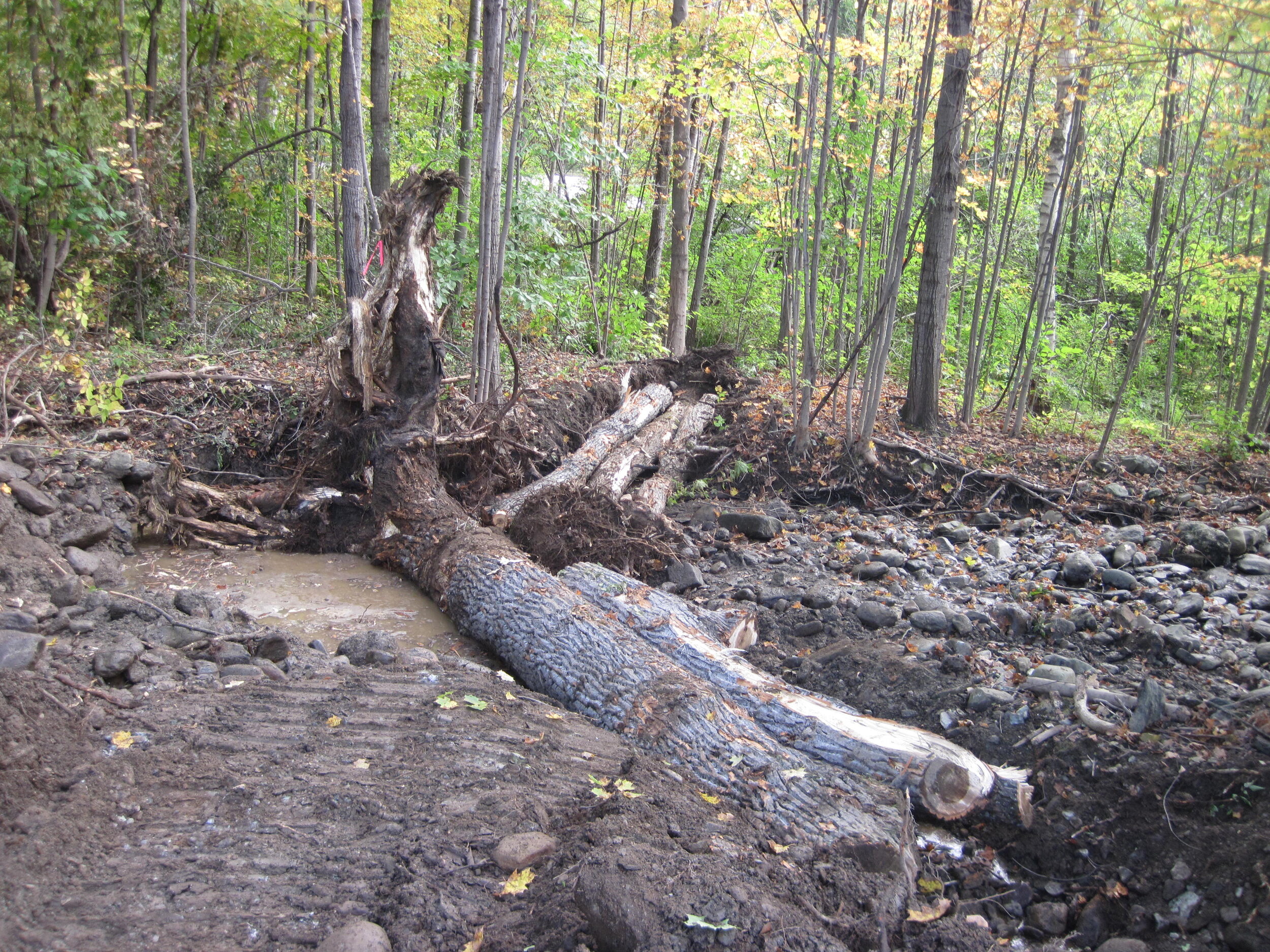
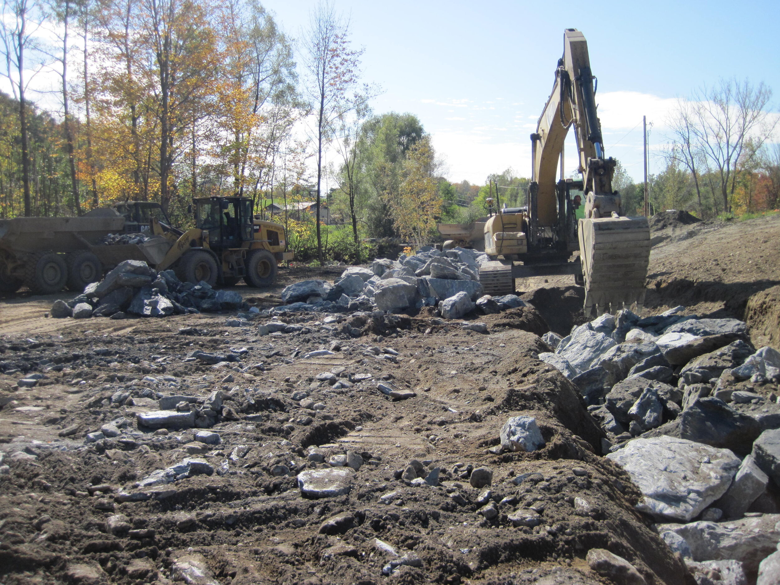
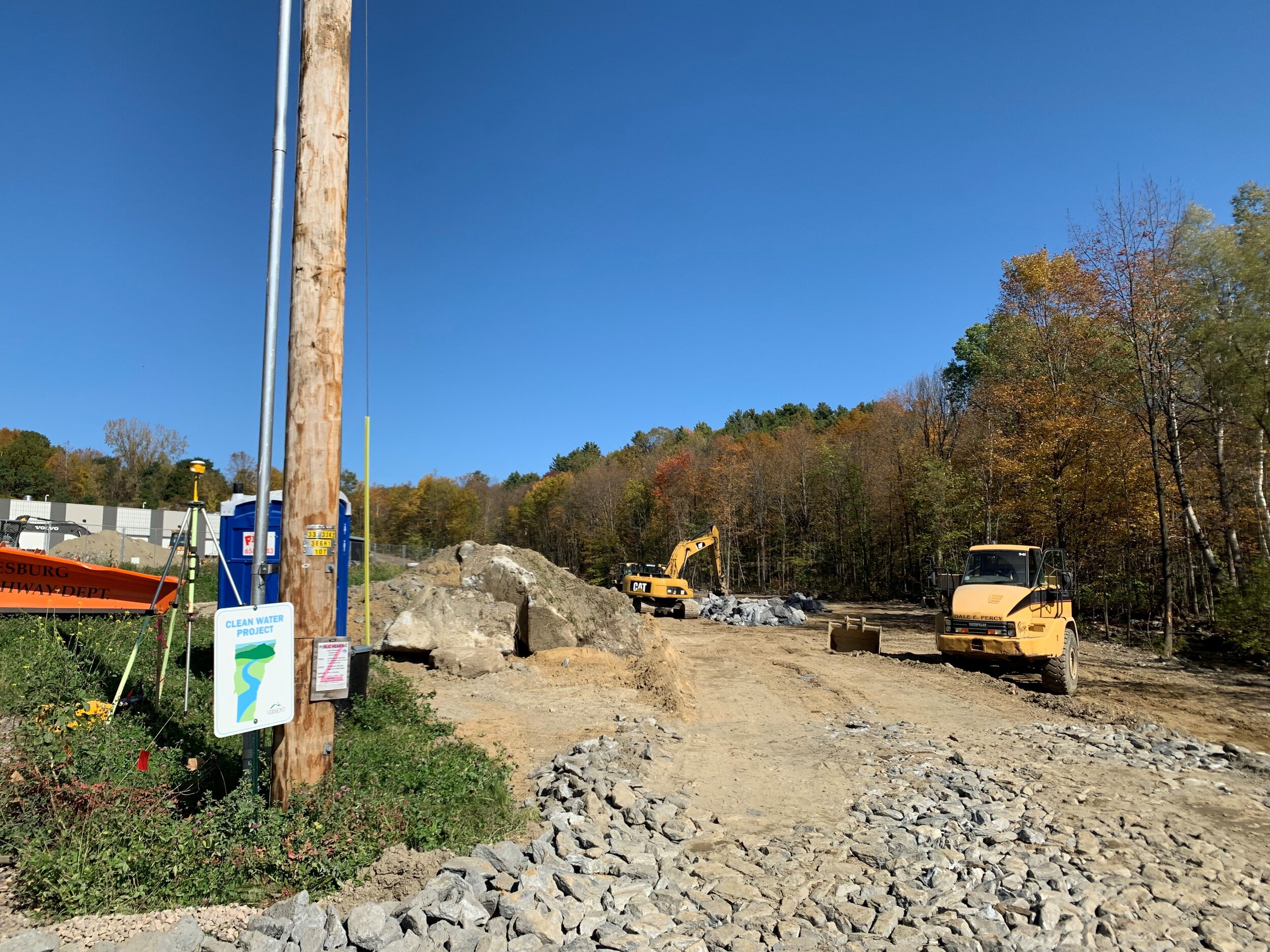
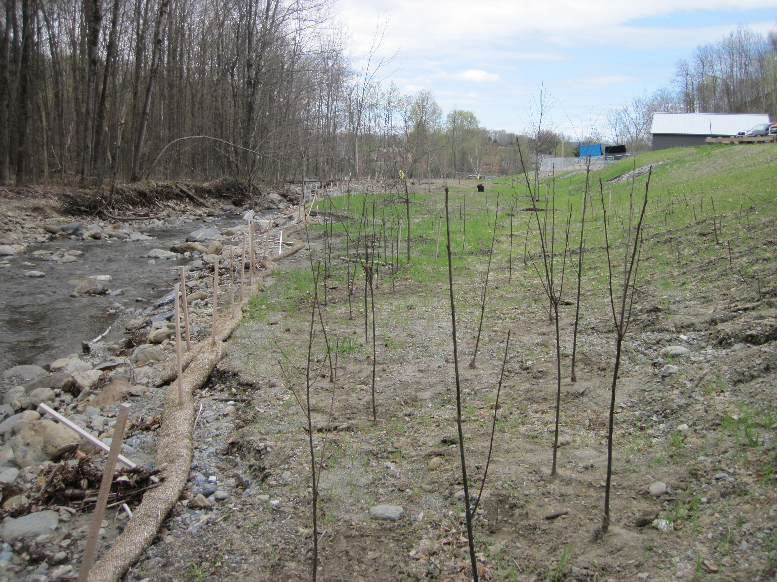
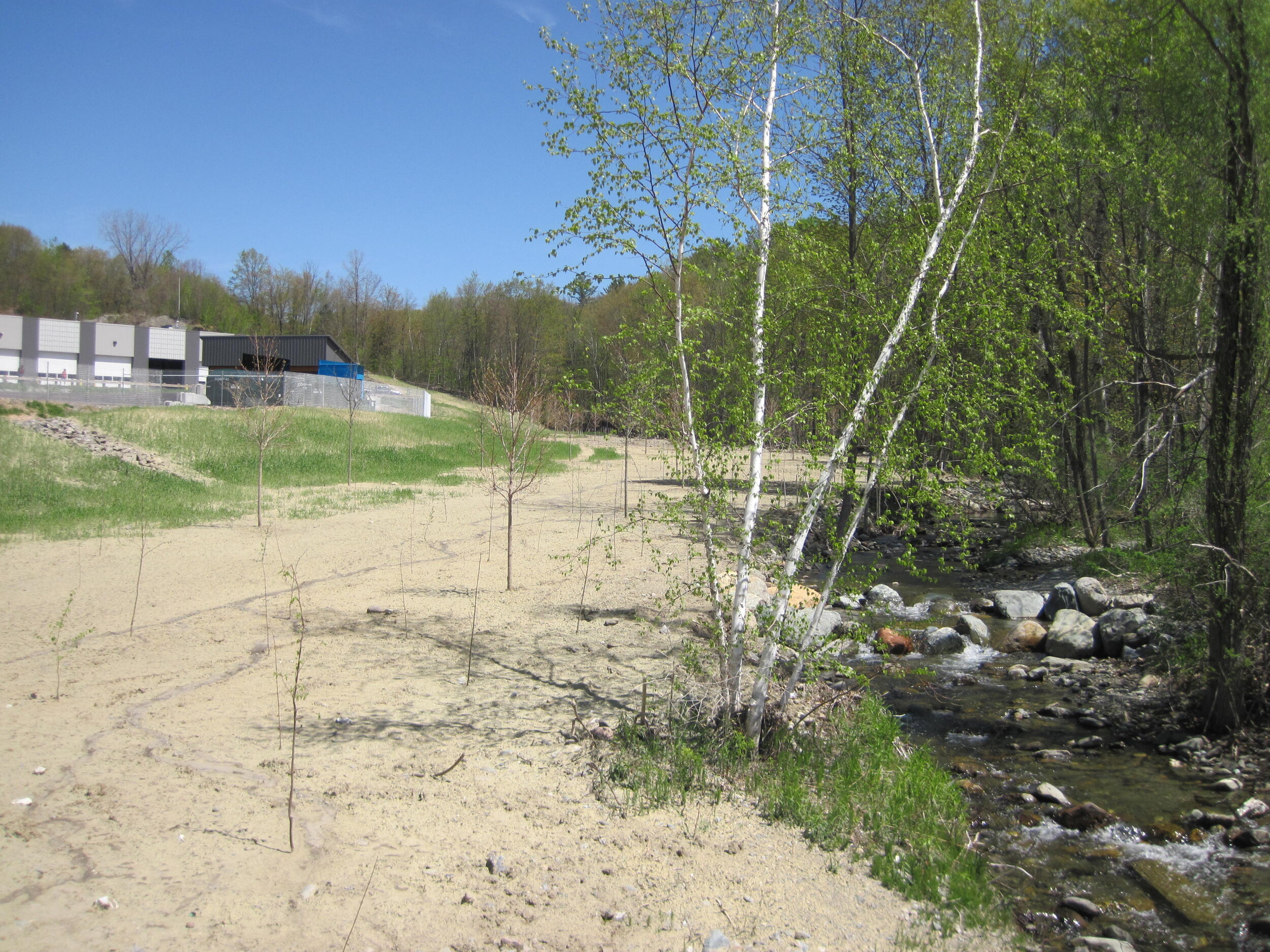
The Vermont Ecosystem Restoration Program (ERP) funded studies in 2007 and 2008 that showed Beecher Hill Brook (which drains into the LaPlatte River in Hinesburg) as incised and disconnected from its historic floodplain due to berming, nearby buildings and fill, channel straightening, and subsequent down-cutting and river bank erosion. In particular, studies supported by ERP and the Lewis Creek Association identified the Hinesburg Town Garage site (adjacent to Beecher Hill Brook) as an area that could be restored through berm removal and floodplain reconnection, in order to improve water quality in the LaPlatte. This site contained impervious surface, buildings, heavy equipment activity, berms, fuels, and open gravel pits right next to the brook. The brook was down-cutting, causing erosion of stream banks, and if it continued, could de-stabilize the North Road culvert (just upstream). Thanks to a 2018 grant award from the Vermont Agency of Natural Resources to Lewis Creek Association (LCA), a final floodplain restoration design was prepared by Milone & McBroom in cooperation with the Town of Hinesburg. A 2019 ERP grant has now allowed this floodplain restoration to be constructed! This will help reduce sediment inputs to Beecher Hill Brook, the LaPlatte River, and eventually Lake Champlain, thereby improving water quality.
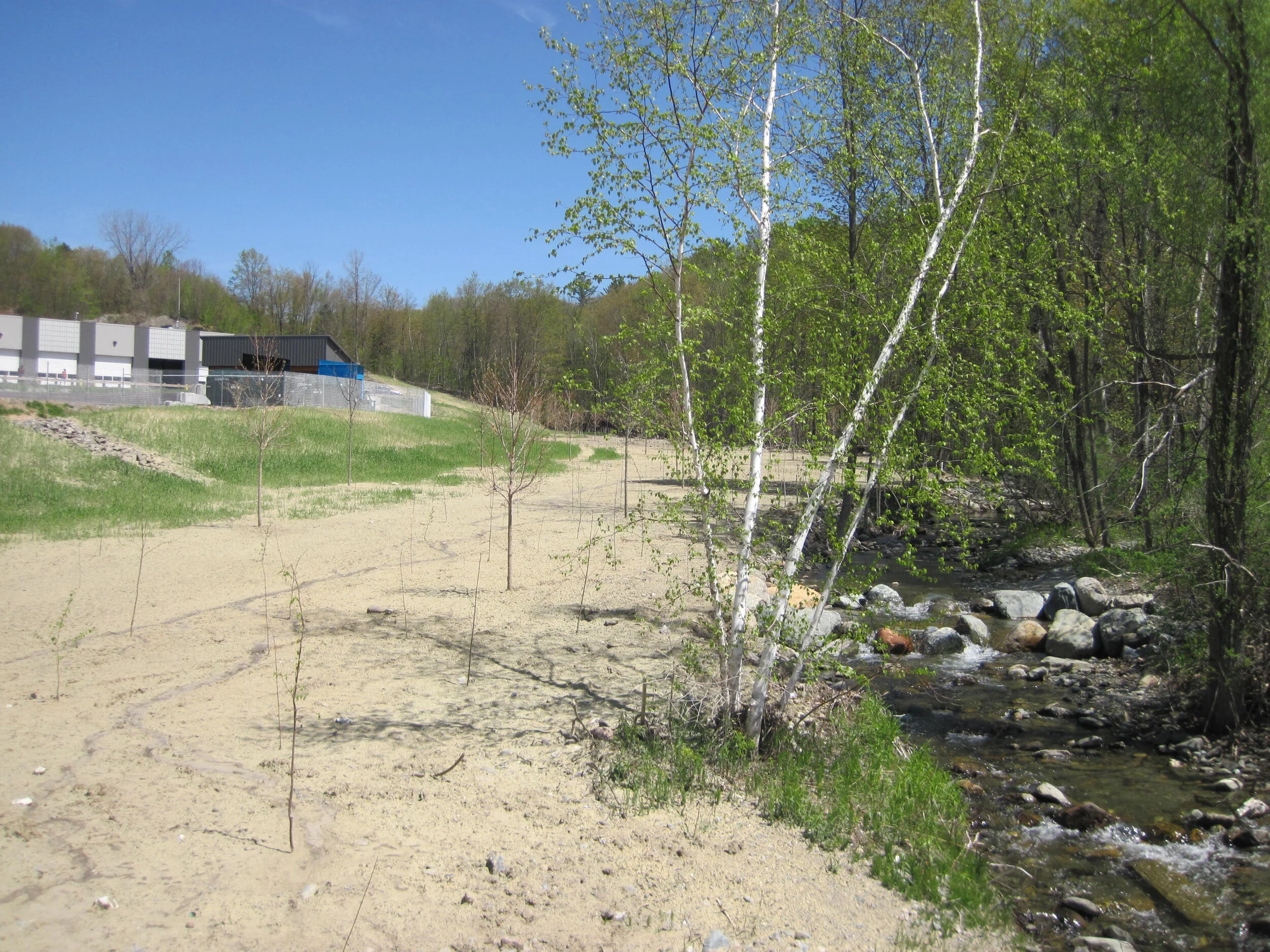
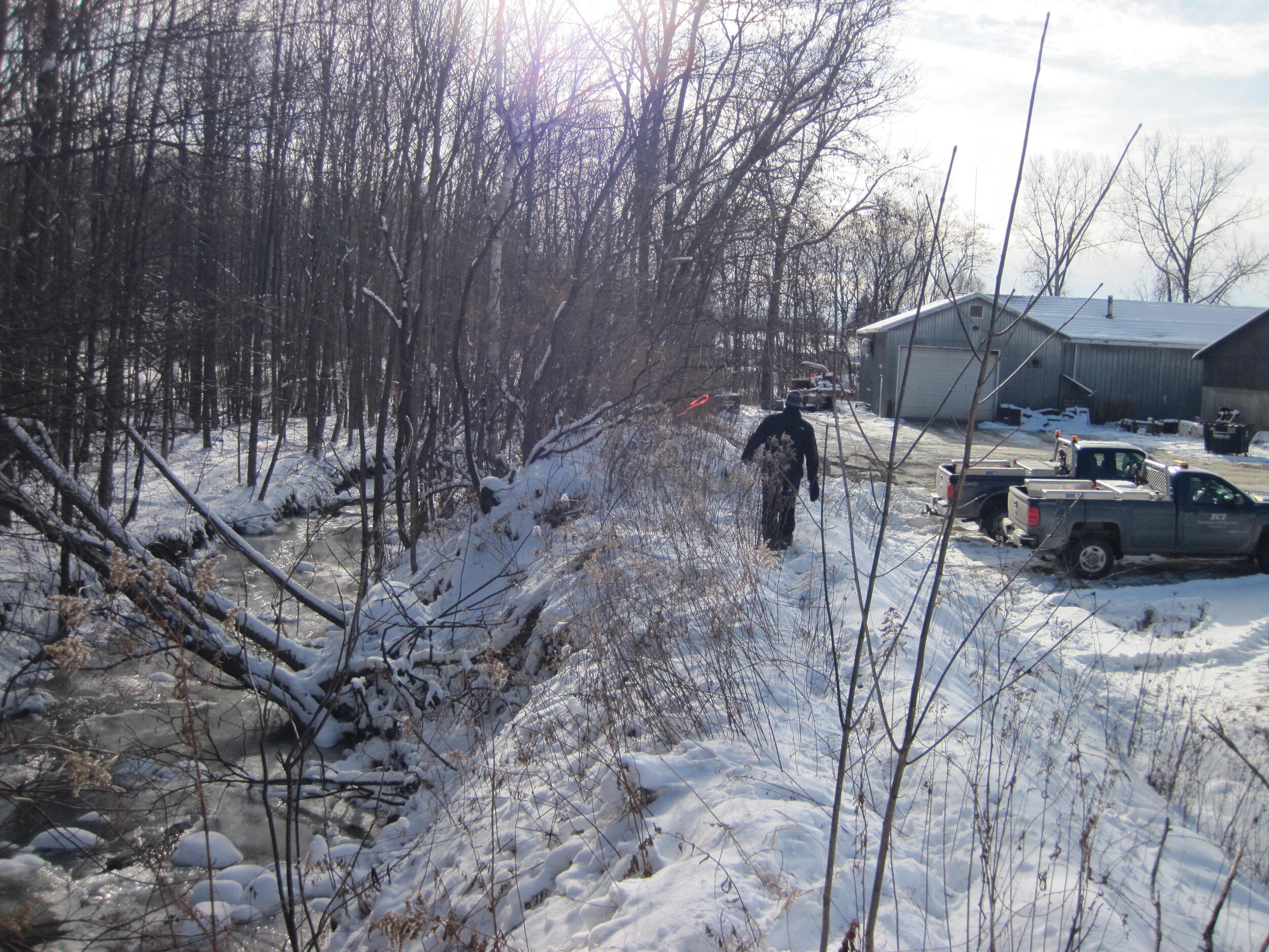
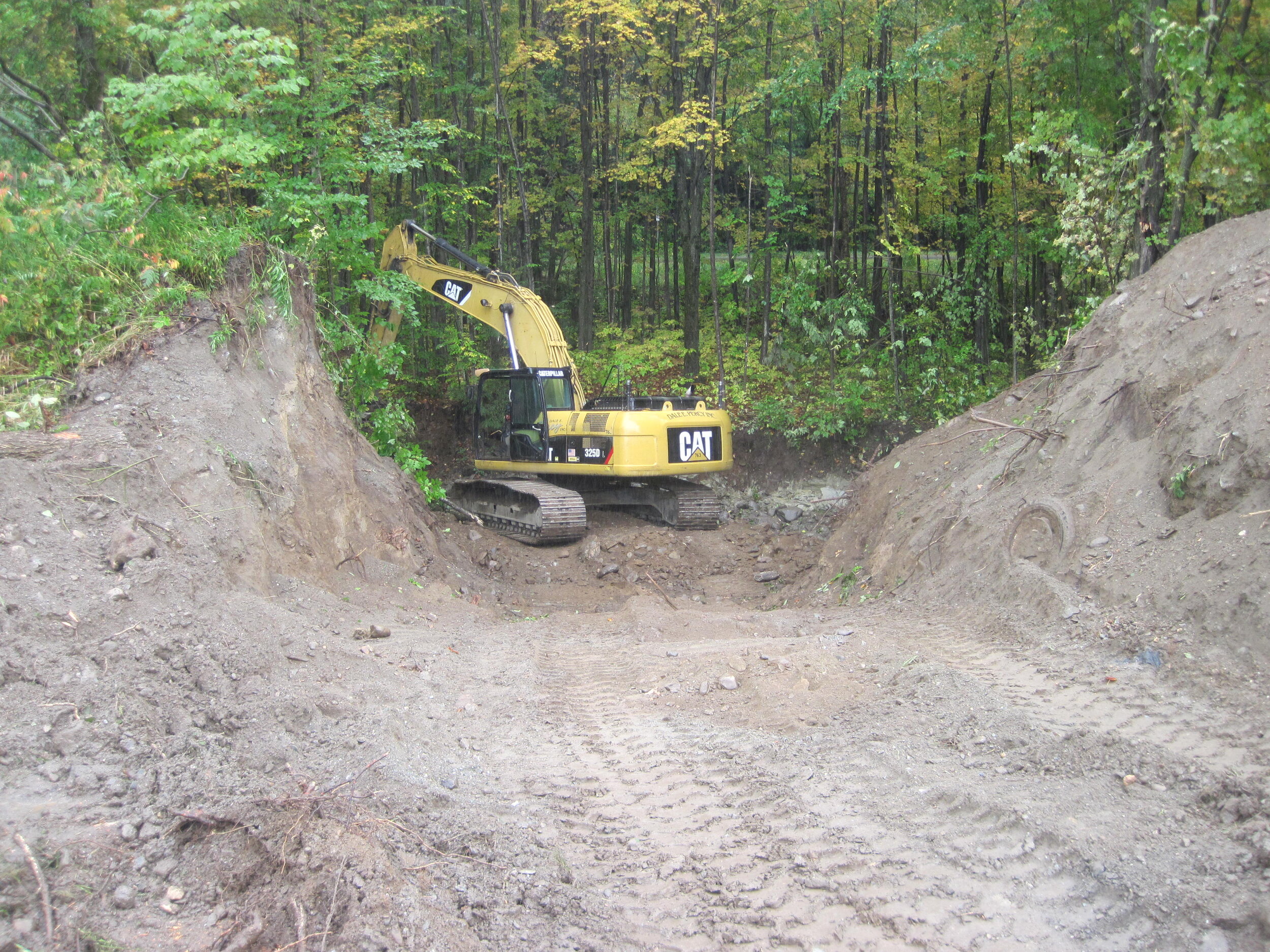
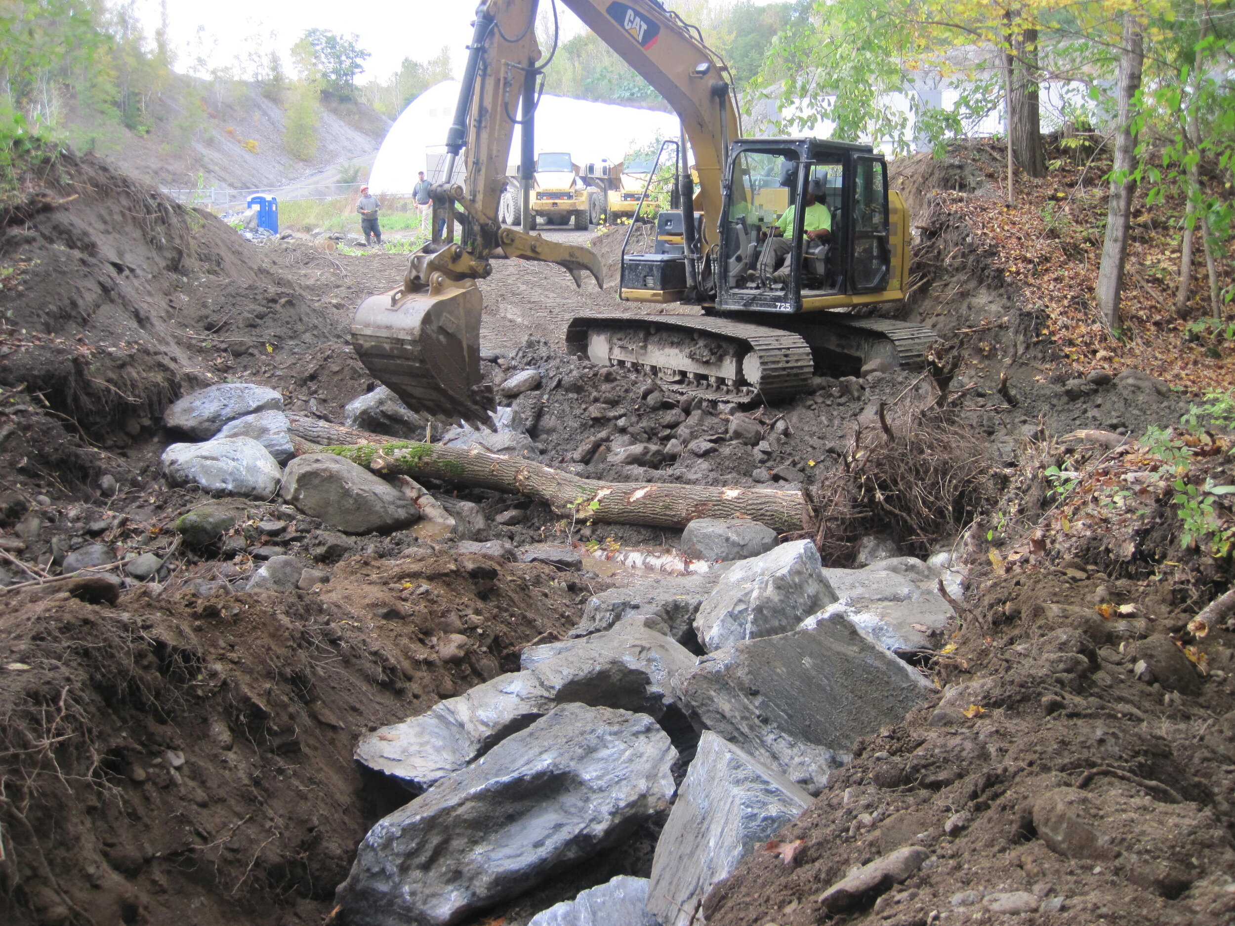
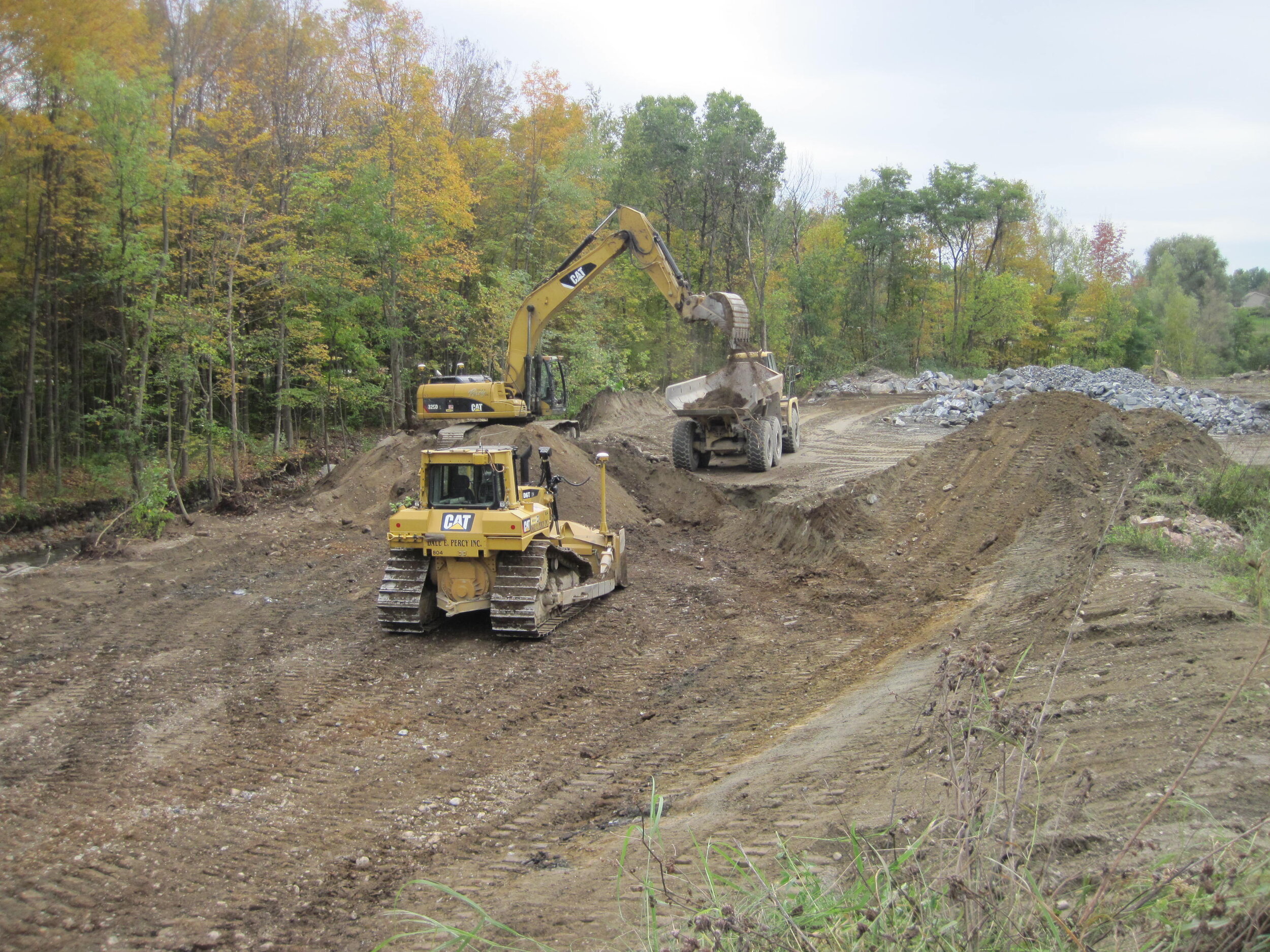
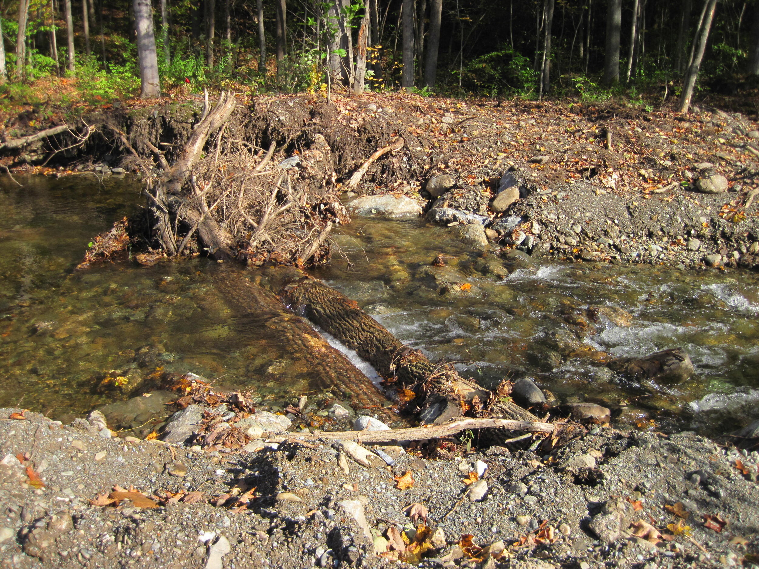
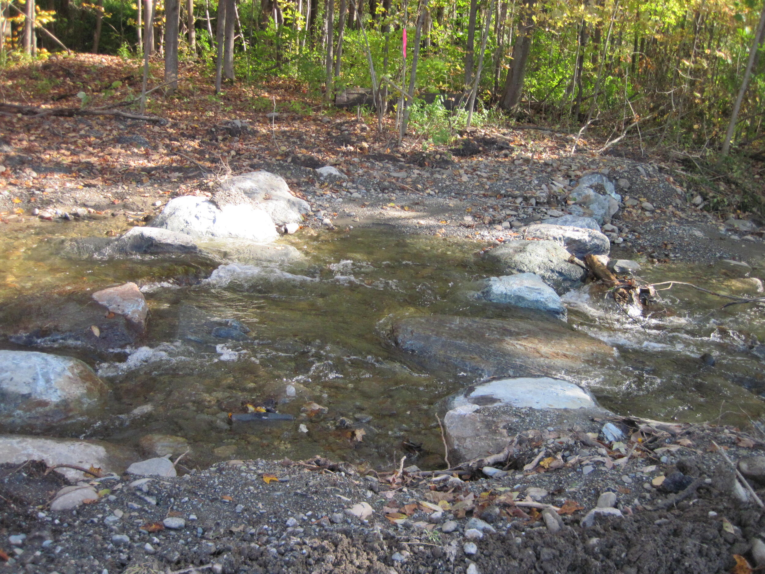
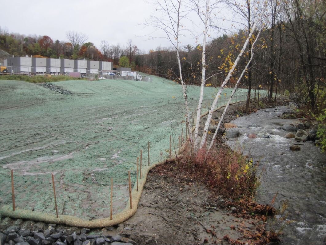
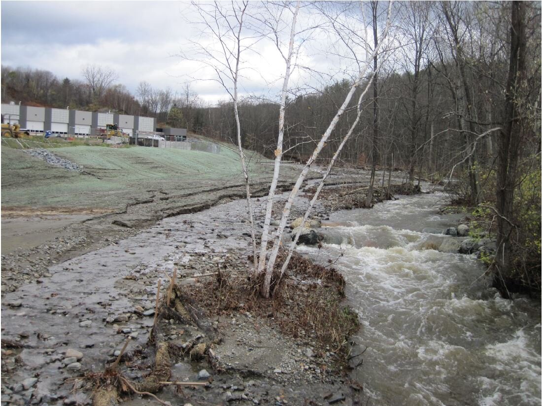
In 2018, the Town of Hinesburg passed a bond vote for redevelopment of the site, and Town Garage buildings were removed from near the brook area in the fall of 2018. In 2019 and 2020, Lewis Creek Association worked with the Town of Hinesburg, engineers from Milone and MacBroom, and contractors from Dale E. Percy, Inc. to excavate earth fill and haul to an upland location onsite, install heavy stone fill, install channel bed raising features (rocks and logs), tree planting of over 400 trees, and site restoration. Tree planting began this spring after a slight delay due to coronavirus, and is now completed!
The improved connection between the channel and floodplain will provide an area for water to slow, sediment to be deposited, and nutrients to be taken up by vegetation. The removal of fill will reduce future down-cutting and erosion and avoid de-stabilizing the North Road culvert (just upstream).
The Beecher Hill Brook floodplain restoration project is part of LCA’s Ahead of the Storm (AOTS) program, which aims to showcase a range of landscapes and land uses and a variety of optimal conservation practices that mitigate stormwater flows, and to be more flood resilient in an effort to improve water quality in an ever-changing climate. For more information on the Ahead of the Storm Program, visit www.lewiscreek.org/ahead-of-the-storm. Lewis Creek Association looks forward to seeing this site grow up to a beautiful forested floodplain over time, thereby helping protect downstream water quality in Lake Champlain!
Photos courtesy of Jessica Louisos, Milone & MacBroom, and Kate Kelly, Lewis Creek Association